MIM Ireland Counties Map with Roads & vector contours @ 1/1,000,000 scale
£155.00
Out of stock
SKU
MIMIRE1MVADMIN/VCONTOUR/ROAD
Product code: 364
ROYALTY FREE, LIFELONG LICENCE. Ireland Map at 1:1,000,000 scale, suitable for use up to A3. 100% editable and fully layered in Adobe Illustrator, choose from Illustrator 5-10 or CS versions. Layers include Roads (Primary routes, 'A' roads and Motorways), Motorway junctions & M'way Services, Railways, Airports, Ferries, Rivers & Lakes, Cou
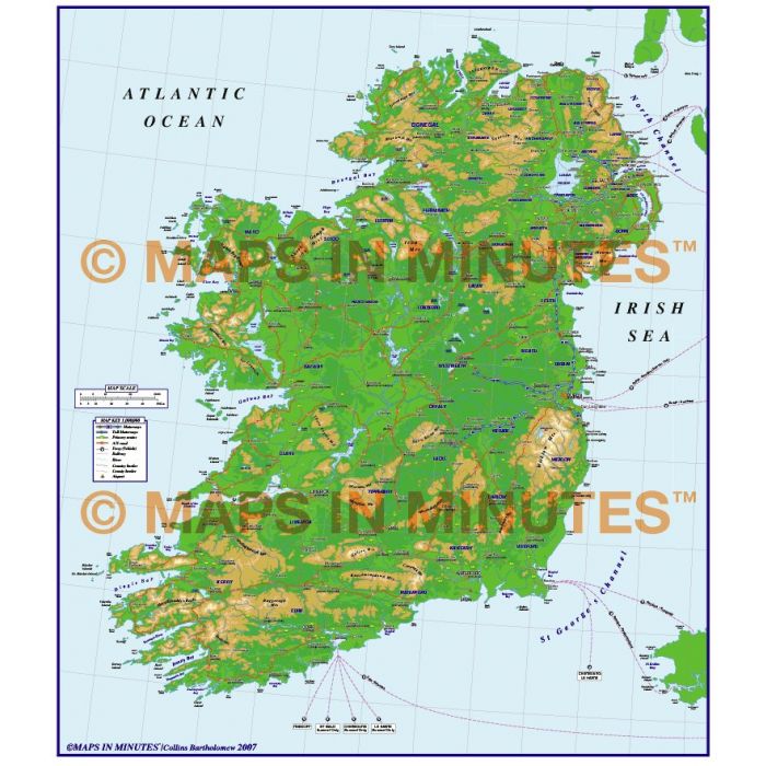
ROYALTY FREE, LIFELONG LICENCE. Ireland Map at 1:1,000,000 scale, suitable for use up to A3. 100% editable and fully layered in Adobe Illustrator, choose from Illustrator 5-10 or CS versions. Layers include Roads (Primary routes, 'A' roads and Motorways), Motorway junctions & M'way Services, Railways, Airports, Ferries, Rivers & Lakes, County/Region/Admin boundaries and fills, vector contours, Physical features (Mountain ranges, river names, lake names, island names etc.) plus urban areas.
ROYALTY FREE, LIFELONG LICENCE. Ireland Map at 1:1,000,000 scale, suitable for use up to A3. 100% editable and fully layered in Adobe Illustrator, choose from Illustrator 5-10 or CS versions. Layers include Roads (Primary routes, 'A' roads and Motorways), Motorway junctions & M'way Services, Railways, Airports, Ferries, Rivers & Lakes, County/Region/Admin boundaries and fills, vector contours, Physical features (Mountain ranges, river names, lake names, island names etc.) plus urban areas.
ROYALTY FREE, LIFELONG LICENCE. Ireland Map at 1:1,000,000 scale, suitable for use up to A3. 100% editable and fully layered in Adobe Illustrator, choose from Illustrator 5-10 or CS versions. Layers include Roads (Primary routes, 'A' roads and Motorways), Motorway junctions & M'way Services, Railways, Airports, Ferries, Rivers & Lakes, County/Region/Admin boundaries and fills, vector contours, Physical features (Mountain ranges, river names, lake names, island names etc.) plus urban areas.