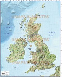
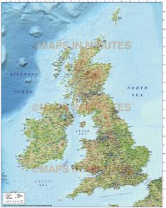
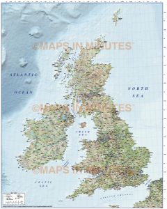
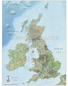
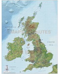
Whole UK Road Relief Maps

Complete up-to-date 2022 Digital British Isles-UK road, rail, county maps with physical shaded relief options in Illustrator editable layered vector format.
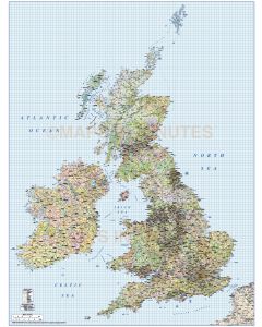
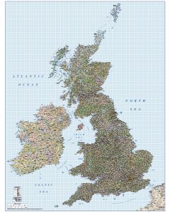
Our Digital British Isles-UK Road, Rail with Shaded relief maps are available in either large scale (750k to 500k), medium scale (1m) and small scale (5m). We offer the most comprehensive selection of detail including countries, counties, major and minor settlements, roads (with road numbering) from motorways with junctions, primary routes, 'A' roads, 'B' roads and 'C' roads down to unclassified, railways, land water features (such as rivers, lakes & reservoirs), physical features (such as mountain ranges, plains and sea features), river names, lake/Loch names, spot heights in metres, airports, m’way service stations (content dependent on map scale). The 300 dpi tiff format shaded relief backgrounds are embedded into the map layering, not linked. Certain maps may include ocean floor and land contours.
Our digital maps are accurately drawn to the Ordnance Survey Transverse Mercator projection,
the de facto projection to match the National Grid system.
Our Illustrator vector maps are of the highest quality and will remain so whatever size you use them. Fully layered and 100% editable including editable font text. Sets of these maps are available within the British Isles Map Collections category which offer significant price savings.
-----------------------------------------------------