Gall Projection @100m scale UK centric with country inset fills
ROYALTY FREE Gall Projection Political World map @100m scale. Fully editable and layered in Illustrator and PDF vector formats. You can turn the layers on or off, customise the lines, fills and editable font text, add your own information to create your own styles. This map has extra layers to enable the user to create a multitude of styles including older style mapping using the country inset layers, you have full control over which ones to use or keep it plain by turning them off. Use in design, print, web, apps and much more.
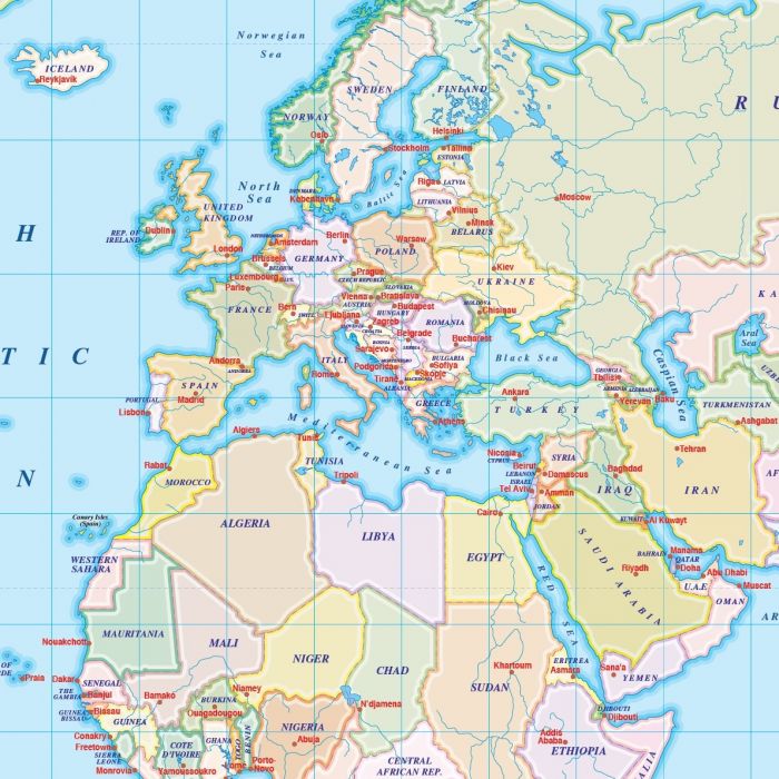
Gall Projection Political World Map (UK centric) with Country fill insets @1:100,000,000 scale
Fully editable small scale digital vector World map in a choice of formats..
Layers include: Coastlines, country borders, country fills (as separate objects), country inset fills, country names, sea/ocean names, rivers, major lakes, capital cities plus latitude/longitude @10 degree intervals.
Formats: Choose from Illustrator CS (for use with Illustrator CS1 to CS6 or later), Adobe Acrobat Editable PDF 6.0 format or 600 dpi tiff format. Our maps in PDF 6.0 format are fully layered within Acrobat but can still be opened and edited in Illustrator CS4 -CS6 while retaining full layering with 100% editability. Our Tiff files are single layer.
Map dimensions: 17" D x 22.2" W (43.3cm D x 56.3cm W)
Extracted Document sizes: Illustrator CS: 5.7Mb Acrobat PDF: 2.8Mb Tiff format: Coming soon
Licence: Please click on the Licence tab to download and print the lifelong licence for this product.
How to download: You will be able to download by logging into Your Account where you can check the status and details of orders (including the applicable Product End User Licence). You can download product purchases for a period of 10 days from date of purchase.
Please note: Product purchases and invoices are downloadable only and are not sent to any postal address
Authors notes: This map is updated for 2014 including newly created South Sudan. These small scale maps in Illustrator and PDF formats contain three layers of the country fills, each layer a different colour density, giving you an immediate choice. Suitable for use from under A4 up to A3+ size. If you would prefer to purchase a set of world maps please visit our World Map Collections category.
| Licence | Lifelong |
|---|