Digital Political World Map, Gall Orthographic Projection Europe centric, small scale
Buy 2022 Digital vector Political World map with countries, capital cities and water features. Gall Orthographic Projection, Europe centered, small scale (A4). Fully editable and layered in Illustrator and PDF formats.
You can turn the layers on or off, customise the lines, fills and editable font text, add your own information to create your own styles.
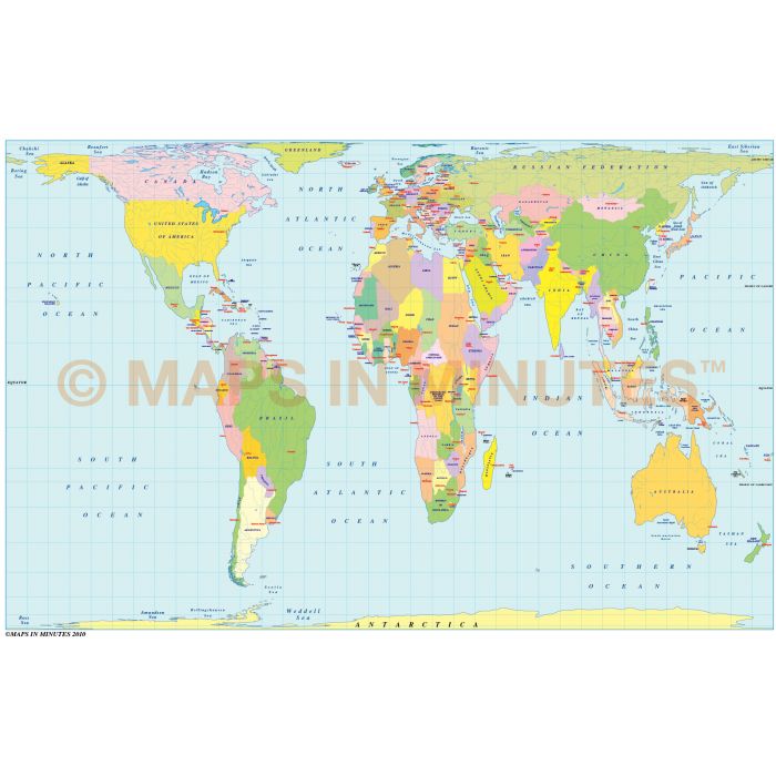
Digital Political World Map with Countries, Capital Cities and water features, Gall Orthographic Projection, Europe-centric @1:100m scale (A4)
Fully editable and layered small scale World Political map for Illustrator CS6/CC format.
Layers include: Coastlines, country borders, country fills (as separate objects), country names, sea/ocean names, rivers, major lakes, capital cities plus latitude/longitude @ 10 degree intervals.
Formats: Choose Illustrator CS6 (for use with Illustrator CS6 or CC) or Adobe Acrobat Editable PDF 6.0 format (on request). Our maps in PDF 6.0 format are fully layered within Acrobat but can still be opened and edited in Illustrator CS6/CC while retaining full layering with 100% editability.
Map dimensions: 8" D x 10" W (28.26cm D x 21.72 cm W)
Extracted Document sizes: Illustrator CS: 4Mb Acrobat PDF: On request
Licence: Please click on the Licence tab to download and print the lifelong licence for this product.
How to download: You will be able to download by logging into Your Account where you can check the status and details of orders (including the applicable Product End User Licence). You can download product purchases for a period of 10 days from date of purchase.
Please note: Product purchases and invoices are downloadable only and are not sent to any postal address
Authors notes: This map is updated for 2022. These small scale maps in Illustrator and PDF formats contain three layers of the country fills, each layer a different colour density, giving you an immediate choice of colour strengths. Suitable for use up to A4 size or a little larger. If you would prefer to purchase a set of world maps please visit our Map Collections category.
Gall Orthographic Projection- An equal area projection (correctly representing areas of the sphere on the map) ideal for graphic display of specific themes such as distribution of population, resources, vegetation or industrial activity. Chosen by several religious bodies and organizations involved in Third World development (including United Nations and OXFAM). Devised in 1855 and identical to Peters Projection (devised in 1967), the Gall Orthographic is also referred to as Gall-Peters Projection - for further information please click HERE.
| Licence | Lifelong |
|---|