Detailed Scotland vector Road Rail Map, Orkney & Shetland, Illustrator AI format, large 750k
Scotland, Orkney & Shetland Map, road, rail and regions, large, 2018, highly detailed, layered in Illustrator CS AI & pdf vector formats. Suitable for use up to any size. Editable font text. Based on Ordnance Survey data. Contains region boundaries and fills. 100% editable.
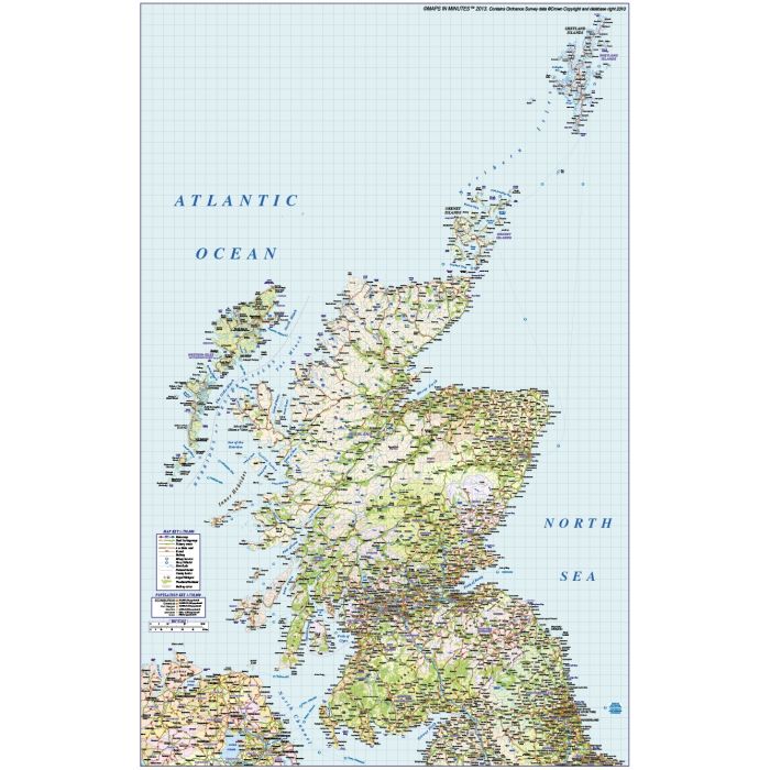
Large up-to-date, highly detailed, 100% editable layered vector map. Suitable for use up to any size. All text is editable font text. Contains Ordnance Survey data. Contains Region/County boundaries and fills.
Formats: Available Illustrator CS4 (for use with Illustrator CS4 to CS6 or later). Our relief tiff files are single layer.
Map dimensions: 27.85" D x 17.8" W (70.7cm D x 45.4cm W)
Extracted Document sizes: Illustrator CS: 1.3Mb Acrobat PDF: 3.6Mb
Licence: Please click on the Licence tab to download and print the lifelong licence for this product.
How to download: You will be able to download by logging into Your Account where you can check the status and details of orders (including the applicable Product End User Licence). You can download product purchases for a period of 10 days from date of purchase. This is a large file.
Please note: Product purchases and invoices are downloadable only and are not sent to any postal address
Authors notes: This stunning map is new for 2018 and is the most highly detailed editable mapping available off the shelf. Also available for purchase are sets of British Isles maps, please see our British Isles Map Collections category.
If you would like a custom map created to your requirements please Contact Us for a quote or give us a call to discuss.
| Licence | Lifelong |
|---|