USA North America Road Rail Map, Illustrator AI CS vector format, detailed, State fills, large size
North America continent map, suitable for use at larger sizes due to the high quality of the map vector line work and carefully crafted placement of text. This Illustrator document is 100% editable including font text. Available in Illustrator CS3, CS4 and CS6/CC. 100% editable including font text. For use from A2 to any size.
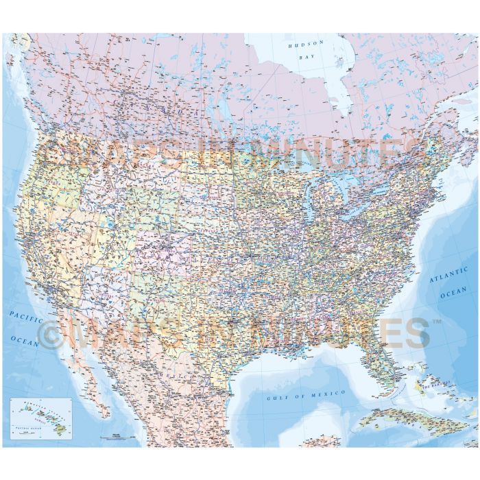
Very highly detailed United States First level Political Road & Rail map.
A political country map and a road and railway map. Fully editable, large scale in Illustrator layered editable format including font text. One document but thousands of possibilities. This is our first US map which has being produced using exclusive Collins Bartholomew vector mapping, there are many more in the pipeline. This is not a map you will find being sold anywhere else.
Perfect for boardrooms, offices, homes and anywhere only the best US map will do. Unique.
Layers include: Coastlines and islands, country boundaries, country fills (as separate objects), capital cities, major settlements (layered by population), roads, railways, country names, island names, sea/ocean names, rivers, major lakes, salt lakes, marshland and other water features, physical features, mountain ranges, spot heights, latitude/longitude, map keys and ocean floor contours.
Formats: Illustrator CS3, CS4 and CS6/CC.
Map dimensions: 34.52" D x 39.63" W (87.68cm D x 100.67cm W)
Extracted Document sizes: Illustrator CS: 110Mb Acrobat PDF: N/A
Licence: Please click on the Licence tab to download and print the lifelong licence for this product.
How to download: You will be able to download by logging into Your Account where you can check the status and details of orders (including applicable Product End User Licence). You can download product purchases for a period of 10 days from date of purchase.
Please note: Product purchases and invoices are downloadable only and are not sent to any postal address
Authors notes: This map is new for 2015. Suitable for use from A2 up to any size. We have access to the Collins Bartholomew map library, and this is one of the maps produced by us from that collaboration. This is a serious piece of cartography and shouldn't be confused with any USA political or contour vector map you may have seen for sale elsewhere. If you would prefer to purchase a set of Regions or World maps please visit our World Maps Collections category.
| Licence | Lifelong |
|---|