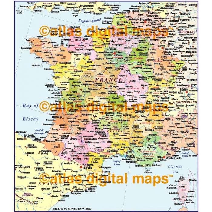
France Regions/Départments map at 4,000,000 scale (Conical projection)
£85.00
Out of stock
SKU
ADMFrance4MRegDeptV
Product code: 287
ROYALTY FREE. France Political Regions/Départments map showing first and second level political divisions. Fully layered and 100% editable in Illustrator 5.0 format, (Illustrator CS and FreeHand MX formats coming soon).
Vector layers include Island names, Physical feature names, Lake and river names, major settlements, airports, coastlines, poli
ROYALTY FREE. France Political Regions/Départments map showing first and second level political divisions. Fully layered and 100% editable in Illustrator 5.0 format, (Illustrator CS and FreeHand MX formats coming soon).
Vector layers include Island names, Physical feature names, Lake and river names, major settlements, airports, coastlines, political borders, vector land fills, latitude & longitude. Conical projection.
ROYALTY FREE. France Political Regions/Départments map showing first and second level political divisions. Fully layered and 100% editable in Illustrator 5.0 format, (Illustrator CS and FreeHand MX formats coming soon). Vector layers include Island names, Physical feature names, Lake and river names, major settlements, airports, coastlines, political borders, vector land fills, latitude & longitude. Conical projection.
ROYALTY FREE. France Political Regions/Départments map showing first and second level political divisions. Fully layered and 100% editable in Illustrator 5.0 format, (Illustrator CS and FreeHand MX formats coming soon). Vector layers include Island names, Physical feature names, Lake and river names, major settlements, airports, coastlines, political borders, vector land fills, latitude & longitude. Conical projection.