Digital Political World Map, Robinson Projection Europe centered, small scale
Buy 2022 Digital vector Political World map with countries, capital cities and water features. Robinson Projection, Europe centered, small scale (A4). Fully editable and layered in Illustrator and PDF formats.
You can turn the layers on or off, customise the lines, fills and editable font text, add your own information to create your own styles.
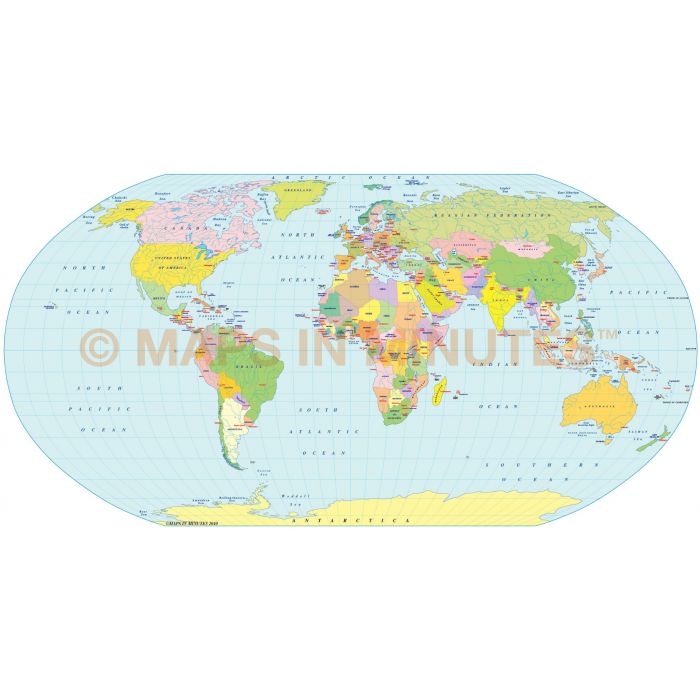
Digital Political World Map with Countries, Capital Cities and water features, Robinson Projection, Europe-centric @1:100m scale (A4)
Fully editable and layered small scale World Political map for Illustrator CS6/CC format.
Layers include: Coastlines, country borders, country fills (as separate objects), country names, sea/ocean names, rivers, major lakes, capital cities plus latitude/longitude @ 10 degree intervals.
Formats: Choose Illustrator CS6 (for use with Illustrator CS6 or CC) or Adobe Acrobat Editable PDF 6.0 format (on request). Our maps in PDF 6.0 format are fully layered within Acrobat but can still be opened and edited in Illustrator CS6/CC while retaining full layering with 100% editability.
Map dimensions: 8" D x 10" W (28.26cm D x 21.72 cm W)
Extracted Document sizes: Illustrator CS: 4Mb Acrobat PDF: On request
Licence: Please click on the Licence tab to download and print the lifelong licence for this product.
How to download: You will be able to download by logging into Your Account where you can check the status and details of orders (including the applicable Product End User Licence). You can download product purchases for a period of 10 days from date of purchase.
Please note: Product purchases and invoices are downloadable only and are not sent to any postal address
Authors notes: This map is updated for 2022. These small scale maps in Illustrator and PDF formats contain three layers of the country fills, each layer a different colour density, giving you an immediate choice of colour strengths. Suitable for use up to A4 size. If you would prefer to purchase a set of world maps please visit our Map Collections category.
What is a Robinson Projection?
Graphic Shape: Pseudo-cylindrical
Category: Technical, Graphic
Usage: General reference world maps; used by Rand McNally, the National Geographic Society and others for numerous world maps.
The Robinson projection is a map projection of a world map which shows the entire world at once. It was specifically created in an attempt to find a good compromise to the problem of readily showing the whole globe as a flat image.[1]
The Robinson projection was devised by Arthur H. Robinson in 1963 in response to an appeal from the Rand McNally company, which has used the projection in general-purpose world maps since that time. Robinson published details of the projection's construction in 1974. The National Geographic Society (NGS) began using the Robinson projection for general-purpose world maps in 1988, replacing the Van de Grinten Projection. In 1998 NGS abandoned the Robinson projection for that use in favor of the Winkel Tripel projection as the latter "reduces the distortion of land masses as they near the poles".
Source: Wikipedia
| Licence | Lifelong |
|---|