UK Road and County map, Illustrator AI CS PDF vector formats, 5m small scale
Small scale, detailed, 100% editable, layered vector County Administrative road map of the U.K. in either Illustrator or editable PDF format. Suitable for use from A4 to A3+. All text is editable font text. Projection matches Ordnance Survey data and grid co-ordinates.
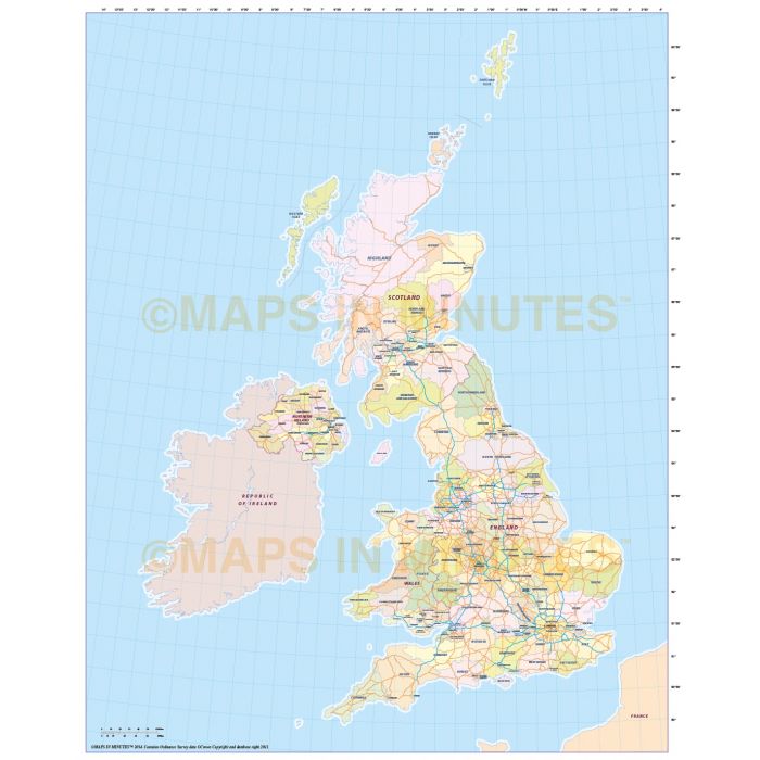
Digital Road Map of the United Kingdom, County/Administrative layers, Illustrator AI CS vector format, @5,000,000 scale
Small scale, simple map of the UK administrative divisions plus simple major roads and motorways layers. Suitable for use at virtually any size, being a vector file it will always print to the highest quality.
Layers include: Region/Admin first level boundaries and fills, major roads (primary routes), motorways, coastlines, sea mask (to reverse the map), latitude & longitude, administrative names, country names.
Technical Info/Formats: Choose from Illustrator CS (for use with Illustrator CS1 to CS6 or later) or Adobe Acrobat Editable PDF 6.0 format. Our maps in PDF 6.0 format are fully layered in Acrobat format but can still be opened and edited in Illustrator CS4/CS5 while retaining the full layering with 100% editability.
Map dimensions: 12 inches D x 10 inches W (26cm D x 19.5cm W)
Extracted Document sizes: Illustrator CS: 9.9Mb Acrobat PDF: 6.1Mb
Licence: Please click on the Licence tab to download and print the lifelong licence for this product.
Authors notes: This map is new for 2018. It is very accurate having been drawn based on Ordnance Survey data.
| Licence | Lifelong |
|---|