Australasia Region Countries Basic map @1m scale
Royalty Free. Basic Political Country Map of the Australasia region @10m scale. Available in Illustrator CS1 to CS6 and later, also in layered editable PDF format. 100% editable including font text. For use from A4 to A3+.
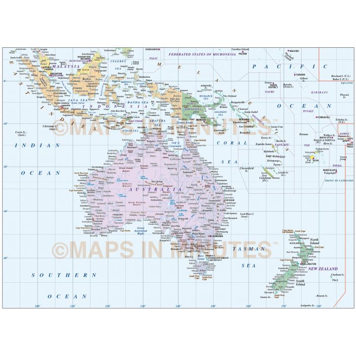
Australasia Basic Region Political map @10,000,000 scale
Fully editable Basic Australasia map in a choice of formats.
Layers include: Coastlines, country borders, country fills (as separate objects), capital cities, major settlements, country names, sea/ocean names, rivers, major lakes plus latitude/longitude @10 and 5 degree intervals.
Formats: Choose from Illustrator CS (for use with Illustrator CS1 to CS6 or later) or Adobe Acrobat Editable PDF 6.0 format. Our maps in PDF 6.0 format are fully layered within Acrobat but can still be opened and edited in Illustrator CS4 -CS6 while retaining full layering with 100% editability.
Map dimensions: 22.94" D x 29.27" W (58.3cm D x 74.63cm W)
Extracted Document sizes: Illustrator CS: 8.2Mb Acrobat PDF: 3.5Mb
Licence: Please click on the Licence tab to download and print the lifelong licence for this product.
How to download: You will be able to download by logging into Your Account where you can check the status and details of orders (including the applicable Product End User Licence). You can download product purchases for a period of 10 days from date of purchase.
Please note: Product purchases and invoices are downloadable only and are not sent to any postal address
Authors notes: This map is updated for 2013. Suitable for use from A4 up to A2 size. If you would prefer to purchase a set of Regions or World maps please visit our World Maps Collections category.
| Licence | Lifelong |
|---|