British Isles County Administrative map @5,000,000 scale
Small scale, detailed, 100% editable layered vector County Administrative map in either Illustrator CS or editable PDF formats. Suitable for use from A4 to A3+. All text is editable font text. Projection matches Ordnance Survey data and grid co-ordinates.
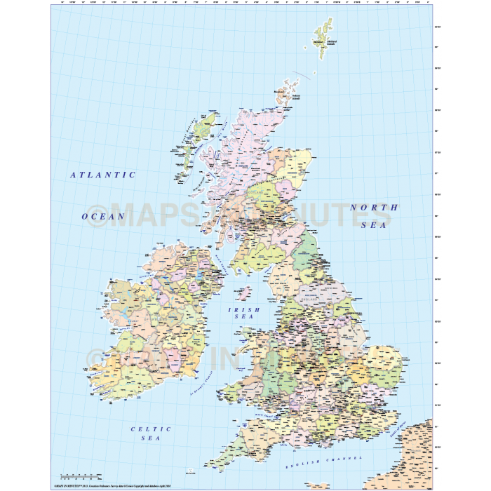
British Isles County/Administrative Map @5,000,000 scale
Suitable for use at virtually any size, being vector based it will always print high quality.
Layers include: Settlements layered by population, Rivers & Lakes, Region/Admin first level boundaries and fills, Physical features (Mountain ranges, river names, lake names, island names etc.). Much of the text also has an outline around in order to improve clarity.
Technical Info/Formats: Choose from Illustrator CS (for use with Illustrator CS1 to CS6 or later) or Adobe Acrobat Editable PDF 6.0 format. Our maps in PDF 6.0 format are fully layered in Acrobat format but can still be opened and edited in Illustrator CS4/CS5 while retaining the full layering with 100% editability.
This map is no longer available in Illustrator Legacy.
Map dimensions: 12 inches D x 10 inches W (26cm D x 19.5cm W)
Extracted Document sizes: Illustrator CS:9.2Mb Acrobat PDF:2.56Mb
Licence: Please click on the Licence tab to download and print the lifelong licence for this product.
Authors notes: This map has been completely re-drawn for 2013. . It is very accurate having been drawn based on Ordnance Survey data. There are a few extra layers which allow the user to create optional styling such as County or Region insets (see screenshots above).
| Licence | Lifelong |
|---|