North America Strong Relief map in Illustrator CS format
Royalty free North America Strong Relief map in Illustrator CS format. Fully layered and editable, this is a great relief map of Northern America with a placed strong colour relief tiff background. The 300dpi relief tiff background is linked to the document.
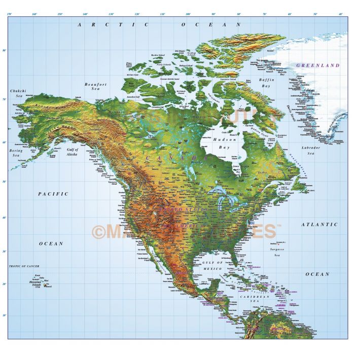
North America Relief Map with a 300dpi Strong colour relief background
Large scale, up-to-date, detailed, 100% editable layered vector map. Suitable for use from A4 up to A2. All text is editable font text.
Layers include: Coastlines, county boundaries, Settlements layered by population. Physical features include rivers, lakes, island names, Mountain ranges, bay and headland names. Product includes a high resolution 300dpi relief background in medium colours as a placed (linked) tiff .
Formats: Available in Illustrator CS1 (for use with Illustrator CS1 to CS6 or later). Our relief tiff files are single layer.
Map dimensions: 37.55" D x 39.58" W (95.37cm D x 100.54cm W)
Extracted Document sizes: Illustrator CS: XXMb plus XXMb placed relief background tiff file.
Licence: Please click on the Licence tab to download and print the lifelong licence for this product.
How to download: You will be able to download by logging into Your Account where you can check the status and details of orders (including the applicable Product End User Licence). You can download product purchases for a period of 10 days from date of purchase. This is a large file so may take a while to download.
Please note: Product purchases and invoices are downloadable only and are not sent to any postal address
Authors notes: This quality map is new for 2013.
| Licence | Lifelong |
|---|