Europe/Asia/North Africa Large Relief map
ROYALTY FREE. Illustrator layered map with a shaded relief tiff background. Editable vector layers include: Capital cities, major settlements, rivers and lakes, international airports, coastline, first level internal divisions of Russia, China and India. For use at A3 and over. Only available for CS1 through to CS6 or later.
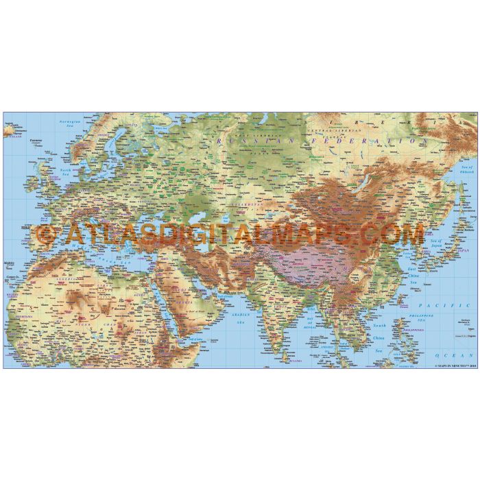
Europe/Asia/North Africa large relief Map @10,000,000 scale in Illustrator and PDF formats.
Large scale Eurasia map in a choice of vector formats.
Layers include: Coastlines and islands, country borders & fills, country names, sea/ocean names, rivers, major/minor lakes, river names, physical names, capital cities, major settlements, major airports plus latitude/longitude.
Map dimensions: xx" D x xx" W (xxcm D x xxcm W)
Extracted Document sizes: Illustrator CS: xxMb
Licence: Please click on the Licence tab to download and print the lifelong licence for this product.
How to download: You will be able to download by logging into Your Account where you can check the status and details of orders (including the applicable Product End User Licence). You can download product purchases for a period of 10 days from date of purchase.
Please note: Product purchases and invoices are downloadable only and are not sent to any postal address
Authors notes: This map is updated for 2013. It has been used often by customers to show the Silk Route. Suitable for use up to any size but if using the whole map it is not suitable for under A4 due to the amount of detail.
| Licence | Lifelong |
|---|