France Basic map at 4,000,000 scale (Conical projection)
ROYALTY FREE. France Basic map. Fully layered and 100% editable in Illustrator CS and PDF formats (coming soon). Vector layers include Island names, Physical feature names, Lake and river names, capital cities and major settlements, coastlines, political borders, vector land fills, latitude & longitude.
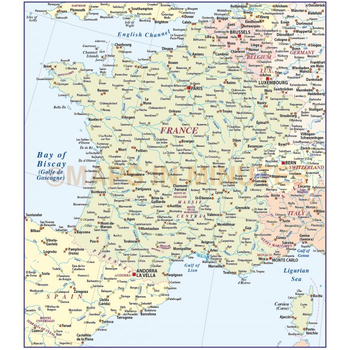
France Basic Country Map at 1:4,000,000 scale.
Layers include: Coastlines and islands, country boundaries, capital cities, major settlements, country names, island names, sea/ocean names, rivers, major lakes and other water features, physical features, mountain ranges, spot heights plus latitude/longitude.
Formats: Choose from Illustrator CS6 (for use with Illustrator CS6 to CC or later), Illustrator CS4 or CS3.
Map dimensions: 10.77" W 12.33" D (27.36cm W 31.34cm D)
Extracted Document sizes: Illustrator CS: 1.1Mb Acrobat PDF: On request
Licence: Please click on the Licence tab to download and print the lifelong licence for this product.
How to download: You will be able to download by logging into Your Account where you can check the status and details of orders (including the applicable Product End User Licence). You can download product purchases for a period of 10 days from date of purchase.
Please note: Product purchases and invoices are downloadable only and are not sent to any postal address
Authors notes: Suitable for use from A4 to A3 size.
| Licence | Lifelong |
|---|