Egypt Deluxe Map 1st level Political with Roads and Rail
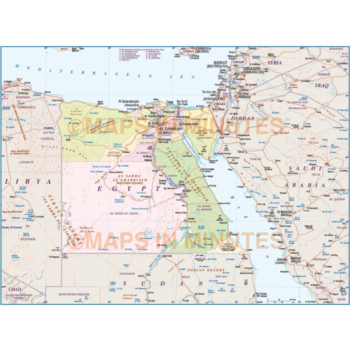
Egypt Country Political Road/Rail Map including first level internal divisions plus land & sea contours
Fully editable large scale Egypt Map in a choice of vector formats.
Layers include: Coastlines and islands, country borders & fills, 1st level Egypt borders & fills, country names, sea/ocean names, rivers, major/minor lakes, capital cities plus fully layered settlements, airports, graticules, roads, railways, physical features, desert features, mountain ranges, river names, lake names, island names etc.
Technical Info/Formats: Choose from Illustrator CS (for use with Illustrator CS1 to CS6 or later) or Adobe Acrobat Editable PDF 6.0 format. Our maps in PDF 6.0 format are fully layered within Acrobat but can still be opened and edited in Illustrator CS4 -CS6 while retaining full layering with 100% editability.
Map dimensions: Map dimensions 9.56in D x 12.93in W (24.2 x 32.8 cm.)
Extracted Document sizes: Illustrator CS 1.6mb - Acrobat PDF 2.7mb
| Licence | Lifelong |
|---|