British Isles County Administrative map @1,000,000 scale
Large scale, detailed, 100% editable, layered vector County Administrative map in a choice of either Illustrator CS or Acrobat Editable PDF formats. Suitable for use from A3+ to virtually any size. All text is editable font text. Projection matches Ordnance Survey data and grid co-ordinates.
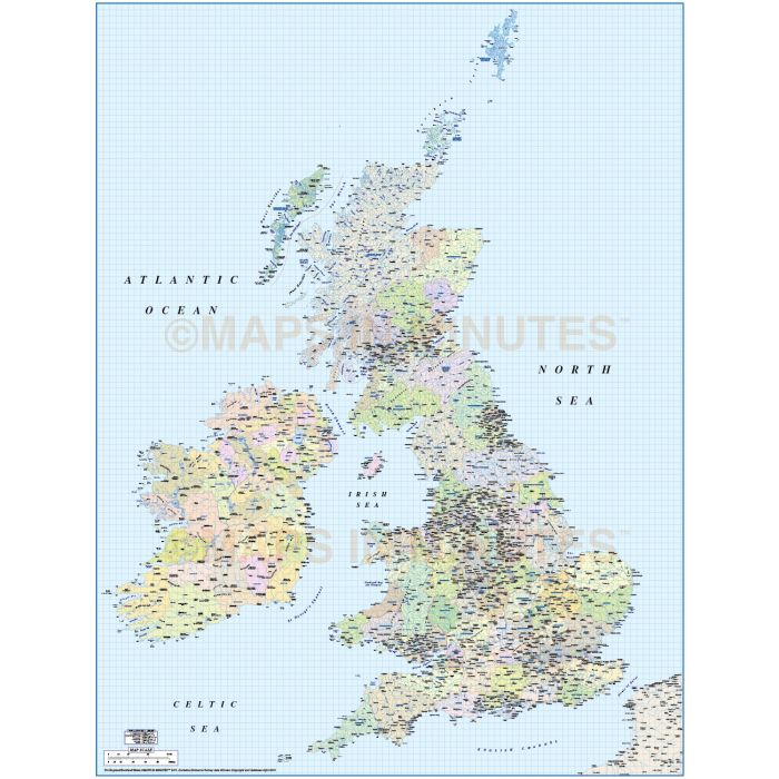
British Isles County/Administrative Map @1,000,000 scale including the Northern Isles
Fully layered, 100% editable, high resolution, 1st level complete political map of the British Isles including the Northern Isles of Orkney and Shetland in position. Suitable for use from A3+ to virtually any size, being vector based it will always print to a very high quality. All text is editable font text.
Layers include: County/region first level boundaries and fills as separate objects, settlements layered by population, rivers & lakes, urban areas, physical features, mountain ranges, river names, lake names, island names etc.). Some of the text also has outline layer options which can be used in order to improve text clarity.
Technical Info/Formats: Available in Illustrator CS (for use with Illustrator CS1 to CS6 or later).
Map dimensions: 49.11" D x 37.45" W (124.74cm D x 95.13cm W)
Extracted Document sizes: Illustrator CS: 85.4Mb Acrobat PDF: N/A
Licence: Please click on the Licence tab to download and print the lifelong licence for this product.
How to download: You will be able to download by logging into Your Account where you can check the status and details of orders (including the applicable Product End User Licence). You can download product purchases for a period of 10 days from date of purchase. Time to download will depend on your Broadband speed.
Please note: Product purchases and invoices are downloadable only and are not sent to any postal address
Authors notes: This administrative map is completely re-drawn and updated for 2013. Also available for purchase are sets of British Isles maps, please see our British Isles Map Collections category.
| Licence | Lifelong |
|---|