Central England Basic Map @1,000,000 scale in Illustrator format
Very accurate, 100% editable in Illustrator or editable PDF vector formats. You can choose which layers are required and turn on or off, customise all map elements, lines, fills and editable font text. Use as is or add other information to create your own image.
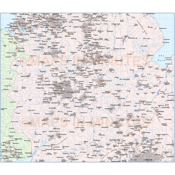
Central England Basic Map @1,000,000 scale in Illustrator and PDF formats
ROYALTY FREE. Up-to-date, detailed coast, boundaries, rivers and lakes, 100% editable layered vector map. Suitable for use up to almost any size. All text is editable font text. Matches Ordnance Survey data and co-ordinates. Contains national boundaries and fills as separate elements which are 100% editable.
Layers include: Coastlines, country boundaries, country fills, settlements layered by population. Physical features include rivers and river names, lakes and lake names, island, bay and headland names.
Formats: Available in Illustrator CS1 (for use with Illustrator CS1 to CS6 or later) or Adobe Acrobat Editable PDF 6.0 format. Our maps in PDF 6.0 format are fully layered within Acrobat but can still be opened and edited in Illustrator CS4 -CS6 while retaining full layering with 100% editability.
Map dimensions: Map size: 8.88"wide x 10.37"deep (22.57cm x 26.34cm)
Extracted Document sizes: Illustrator CS: 20.3Mb Acrobat PDF: 9.3Mb
Licence: Please click on the Licence tab to download and print the lifelong licence for this product.
How to download: You will be able to download by logging into Your Account where you can check the status and details of orders (including the applicable Product End User Licence). You can download product purchases for a period of 10 days from date of purchase.
Please note: Product purchases and invoices are downloadable only and are not sent to any postal address
Authors notes: This map has been completely re-drawn for 2014. We do not just export GIS data to Illustrator and sell it on, we hand draw every line and carefully place every piece of text, even on our simplest maps. It is very accurate having been drawn based on OS data and the area coverage has been increased over the previous Central England edition. All coastlines, boundaries, rivers and lakes are also now at a much greater detail than any previous editions.
| Licence | Lifelong |
|---|